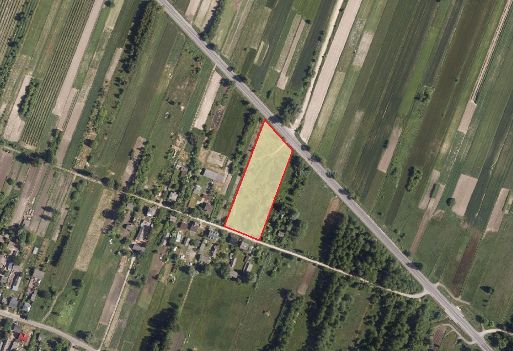
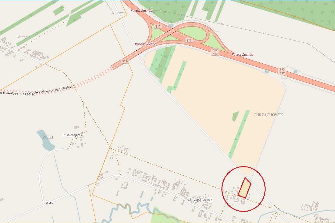
Location
Site name: Chrząchówek 7
Town/Commune: Końskowola
District: puławski
Province (Voivodship): lubelskie
Area of property
Max. area available (as one piece): 0,78 ha
The shape of the site: rectangle
Possibility for expansion: Yes
Property information
Approx. land price [PLN/m2] including 23% VAT: 60 PLN/m2
Owner/s: private
Valid zoning plan: Yes
Zoning: Industry– production, warehouse, wholesales, power engineering
Land specification
Soil class with area: B – 0,1881 ha, R IV a – 0,3187 ha, IV b – 0,2799 ha
Differences in land level: 0,5 m
Present usage: Wasteland
Soil and underground water pollution: No
Underground water level: –
Were geological research done: No
Risk of flooding or land slide: No
Underground obstacles: No
Ground and overhead obstacles: No
Ecological restrictions: No
Buildings / other constructions on site: No
Transport links
Access road to the plot (type and width of access road): asphalt road (width 10 m) and ground road
Nearest motorway / national road: Highway S 12 (is now building) and cross Highway S 17 and Highway S 12 about 2 km from area
Railway line: Puławy – 10 km
Railway siding: Puławy – 7 km
Nearest international airport: Lublin – ok 60 km
Nearest province capital: Lublin – ok 50 km
Existing infrastructure
Electricity: Tak
Connection point (distance from boundary): 0 m
Voltage: small voltage
Available capacity: –
Gas: No
Connection point (distance from boundary): 250 m
Calorific value: –
Pipe diameter: –
Available capacity: –
Water supply: Tak
Connection point (distance from boundary): 1 m
Available capacity: –
Sewage discharge: No
Connection point (distance from boundary): 1 km
Available capacity: –
Treatment plant: No
Telephone: Yes
Connection point (distance from boundary): 1 m
Comments: –
Contact person:
Marcin Nowak – inspektor ds. gospodarki przestrzennej
tel. (81) 88 16 201
e-mail: gp@konskowola.info.pl